
Trending
car·tog·ra·phy: Oh, the places you’ll go
August, 2016
Early explorers didn’t discover the world on their own. Mathematicians and geographers helped guide ships into the unknown, and cartographers interpreted that known world onto maps and globes so that everyone could see what it looked like. Today, cartographers are reshaping our planet with more accurate information than ever—and they’re not just mapping Earth. Here’s a quick look at how cartography shaped our world.
Shaping the globe
Around 150 CE, a Greek mathematician, geographer and astronomer named Ptolemy wrote a book titled Geographia. It contained eight volumes of hand-drawn maps of the known world during the 2nd century. This book, however, was lost for over a thousand years! In the 15th century, it was rediscovered and translated from Greek to Latin so that the educated of the day could understand this man’s great work. Ptolemy is also credited for developing the concept of latitude and longitude.
Up until Geographia was rediscovered, countries were drawn larger if they had more political or economic importance, as opposed to actual size. The resurgence of Geographia spurred a 16th century Flemish man named Gerard Mercator to reintroduce math into cartography. A few of Mercator’s greatest achievements were a detailed globe with Ptolemic grid lines, the creation of codes to help distinguish names of countries, cities and geographical descriptions from one another, and the Mercator’s Projection, which keeps a true bearing when plotting a course (because the parallels of latitude were spaced farther apart the further you travelled from the equator).
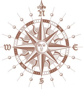
You Are Here
Technological advances have helped cartographers be exact in plotting coastlines, rivers, cities and towns. Various types of maps, such as aerial maps, ocean floor maps, satellite maps, population density maps and human body maps are also now available. Cartography itself has undergone reshaping as it’s now a science all its own, encompassing many branches: geodesy is concerned with using mathematics to determine the shape and size of the Earth; photogrammetry is used primarily for topographic and involves taking stereoscopic photos from planes to measure distances. A global positioning system (GPS), -created originally for the military, uses data sent from 24 satellites orbiting the Earth to provide -location and time information to handheld GPS receivers, including cellphones.
Plotting the Course
Maps of our night sky have been around for millennia, either painted on cave walls, animal skins or parchment. Today, probes, satellites and powerful telescopes are mapping the surfaces of our solar system’s planets and moons—they’re also mapping galaxies beyond our solar system. Earth’s inner space, largely unexplored compared to the rest of the planet, is also being mapped more accurately. Deep-sea submersibles, sonar and satellite altimetry are giving us more detailed views of the ocean beds so scientists can better understand coastal erosion, creation of tsunamis and the impact of rising sea levels. Cartography isn’t only impacting the physical world; the virtual reality world is also being mapped. Scientists may be able to stand on the moon or Mars without the spacesuit; scientists may be able to see how a tornado works without getting into its path; the public may be able to speed on the German Autobahn without having to fly there.
Cartography isn’t just a collection of maps; it shows us the physical and political history of our world. Over millennia, cartographers have added more landmasses to maps, have named the unknown edges of the world and have drawn and redrawn country boundaries after wars. Today, cartographers are mapping the human brain and genomes, the ocean floors and other planets where its Terra Incognito will fuel explorers’ imaginations for millennia to come. t8n
Off by One Percent
In the middle of the 2nd century, a Greek astronomer named Eratosthenes calculated the Earth’s polar circumference without ever leaving Alexandria, Egypt. With his skills in geometry, he calculated 24,662 miles. The actual circumference is 24,860 miles.
Fun Fact
The earliest known document pertaining to Canada is an early 16th century edition of Ptolemy’s Geographia, redrawn by Johannes Ruysch. On the map, Newfoundland and Cape Breton are labelled as Terra Nova. However, the two Canadian islands are a peninsula attached to Asia.


More Trending

Join the T8N E-Newsletter